Building near Lac des Nations versus up on the slopes of Mont-Bellevue presents two completely different soil challenges. One site might sit on soft compressible silts left by the old glacial lake, while the other hits dense glacial till just a meter down. The plate load test can be useful for verifying bearing capacity at shallow depth, but first you need to know the profile. That's exactly what drives the Standard Penetration Test in Sherbrooke. We run the SPT to map out the stratigraphy beneath your lot, giving you the blow counts that translate directly into bearing capacity and settlement predictions. Sherbrooke's post-glacial geology, with its mix of marine clays, Champlain Sea deposits, and rocky outcrops, doesn't forgive guesswork. A solid set of SPT data from our drill crew lets your structural engineer sleep at night, knowing the foundation won't settle unevenly.
An SPT N-value of 4 in Sherbrooke's Champlain Sea clays tells a very different story than an N-value of 4 in the glacial outwash near Lennoxville.
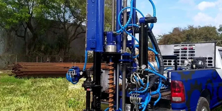
How we work
At 200 meters above sea level along the Saint-François River, Sherbrooke's winter freeze-thaw cycles penetrate deep into the ground. Our SPT equipment follows ASTM D1586 standards, using a 140-pound hammer with a 30-inch drop to drive the split-spoon sampler. We log the number of blows for each 6-inch increment, and the N-value we report is the sum of the last two increments. Why does that matter for a project in Sherbrooke? Because the N-value correlates directly with the relative density of the granular soils common in the Eastern Townships. We also note the soil type at each depth change—you can't interpret an N-value without knowing if you're in sand, silt, or the compact tills that underlie the downtown core. This approach helps you avoid over-excavation and design foundations that match the actual conditions, not the worst-case scenario.
Frequently asked questions
What does an SPT test cost for a typical residential lot in Sherbrooke?
For a standard single-family home lot, budget between CA$670 and CA$1,000 per borehole. The total depends on access, depth, and whether we hit refusal in the till. Most residential jobs in Sherbrooke require two to three boreholes to satisfy the building code.
How do I know if my Sherbrooke soil has liquefaction potential?
The SPT N-value is the primary input for liquefaction assessment. In Sherbrooke, loose saturated sands along the river corridors are the main concern. If your N-values are below 15 in sandy layers and the groundwater is within 3 meters of the surface, we'll flag it for further analysis per NBCC seismic provisions.
How long does the drilling take and will it mess up my yard?
A single borehole to 15 meters usually takes half a day. We use rubber-tracked rigs that minimize ground pressure, and we clean up the cuttings. You'll have a small patch of disturbed soil around the borehole, but we restore the surface as best we can. If you're landscaping the same season, plan the SPT before the sod goes down.
Can you drill through the glacial till that's everywhere in Sherbrooke?
Yes, up to a point. The dense till in the Eastern Townships can produce N-values over 50, which we call 'refusal.' At that depth, we can often switch to coring if we need to know the rock quality, but for most shallow foundations, hitting refusal in the till confirms you have excellent bearing right there.