When you're dealing with the rolling terrain around Sherbrooke, you quickly learn that the slopes here aren't forgiving. The city sits in the St. Francis River valley, and many residential and commercial lots cut into the underlying glacial deposits. We often see projects stalled because the initial geotechnical report flagged a slope but didn't quantify the factor of safety. That's where a proper slope stability analysis comes in. We don't just run a generic model and hand you a number. We look at the stratigraphy from your borehole logs, pore pressure conditions, and the actual geometry of your cut or embankment. For sites near the Magog River or along the steep sections of Mont-Bellevue, the analysis has to account for seasonal saturation and the low shear strength of the Champlain Sea clay remnants. Combining the survey with a CPT test gives us a continuous strength profile that sharpens the input parameters for the model, especially when the clay layers are thin and easy to miss with SPT alone.
A slope that looks stable in August can become a liability in April when the frost comes out and groundwater rises in Sherbrooke's till.
How we work
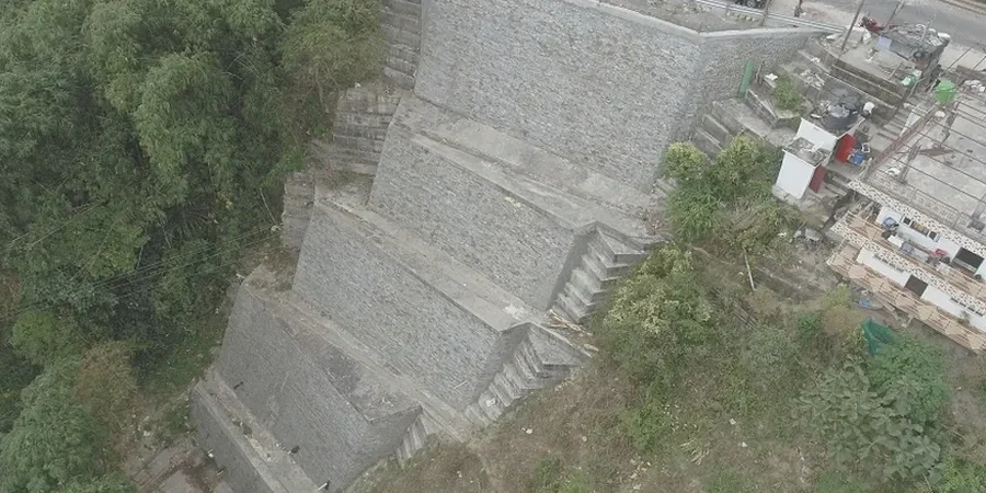
Sherbrooke's geology is dominated by glacial till overlying folded sedimentary rock, primarily shale and slate of the Appalachian foothills. The till matrix is dense but the presence of silt lenses can create perched water tables, which is a headache for slope stability. We routinely see groundwater seepage at the till-bedrock interface after spring melt or heavy rain, a condition that drops the effective stress and triggers shallow failures. Our analysis uses both limit equilibrium methods and finite element modeling when the geometry gets complex, always referencing the National Building Code of Canada and CSA A23.3 for reinforced concrete stabilization elements. We define the critical slip surface for static and pseudo-static conditions because Sherbrooke is in a moderate seismic zone, and the NBCC requires a site-specific seismic hazard assessment for slopes over 6 meters. The output is a clear factor of safety, recommended setback distances, and if needed, a stabilization strategy using soil nailing or anchored walls that works with the local bedrock.
Local ground factors
We run the models from our office, but the input data comes from a drill rig working on your site. For slope work in Sherbrooke, we typically mobilize a compact track-mounted rig that can handle the access on uneven terrain. It's a machine that takes Shelby tube samples and performs SPT tests at the crest and mid-slope without tearing up the access road. The risk we're mitigating isn't abstract: it's the progressive failure that starts with a small scarp at the top and ends with material sliding onto the road or into the foundation. Ignoring a stability assessment on a lot that backs onto a ravine is a gamble. We've seen retaining walls tilt because the global stability wasn't checked, assuming the wall itself would hold the hill. It doesn't work that way. The analysis ties together the soil strength, the groundwater, and the planned excavation so the contractor knows exactly where the safe line is.
Frequently asked questions
What triggers a mandatory slope stability analysis in Sherbrooke?
The City of Sherbrooke's zoning bylaws require a geotechnical study including stability assessment for any construction or major grading on slopes steeper than 20% or within a setback from the crest of a ravine. The analysis must demonstrate a minimum static factor of safety, typically 1.5, and compliance with NBCC seismic requirements.
How much does a slope stability analysis cost in Sherbrooke?
The fee generally ranges from CA$1,720 to CA$4,880, depending on the slope height, the complexity of the stratigraphy, and whether new boreholes are needed. A deep-seated failure analysis in a built-up area will be at the higher end due to the modeling time and peer review requirements.
How long does it take to get the report?
After the field investigation and lab testing are complete, the analysis and report typically take two to three weeks. If stabilization drawings are included, add another week for the structural detailing and coordination with your architect or civil engineer.
What information do you need from us to start?
A topographic survey of the slope and the proposed building footprint is essential. If you have existing borehole logs or a geotechnical report from a previous phase, that helps. We'll also need the municipal permit requirements so we can scope the report to exactly what the city reviewer expects.